
Testing the high definition LIDAR HDL-32E on the Husky A200 for navigation and mapping
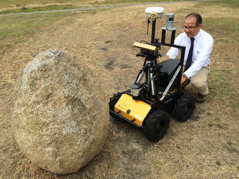
Dr. Geovanni Martinez is testing the high definition LIDAR HDL-32E (3D scanner) on the rover plaform Husky A200 for navigation and mapping. The HDL-32E generates a point cloud of approximately 700,000 points per second with a reange of 70 meters and typical accuracy of +-2cm.